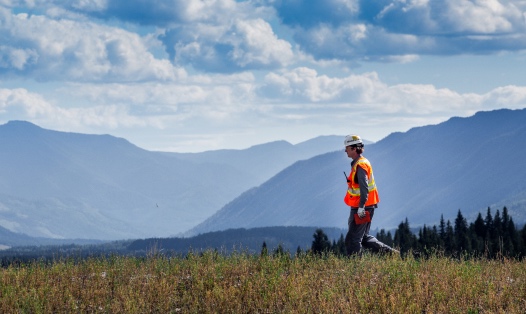
A buzz fills the mountain air. Atop a lookout at Elkview Operations, Brian Bisset, Senior Mine Technician, launches a drone on a crisp morning. He guides it over the haul road and pit while a camera mounted on the drone snaps hundreds of photos during the flight.
Using a process called photogrammetry, Brian will create a map of the mine from the photos to use for long-range planning. In just a few short years, photogrammetry has largely replaced the mine site’s traditional LiDAR mapping, saving time and money, and Brian has been leading the charge.
“We use software to create a point cloud from the photos and in turn create a digital representation of the mine surface,” said Brian. “The process is very similar to LiDAR, RADAR and other technologies used to produce a DSM (digital surface model). For reference, photogrammetry techniques were used in the ‘The Matrix’ to create some of the film’s most visually stunning scenes.”
Brian introduced drones for surveying at Teck operations in the Elk Valley and since that time, the use of drones has quite literally taken off. In fact, Brian anticipates drone use will go even further. “I envision a day in the not too distant future that industrial drones will be able to automatically survey or photograph large areas without an operator needing to be present,” said Brian.
When he’s not using a drone to capture the landscape, Brian enjoys spending time behind the lens of his own camera. An avid photographer, Brian’s work features the local region, from mountains to mine equipment. He also enjoys rugby and gaming to keep his reflexes sharp.
“I live and work in one of the most beautiful places on the planet AND I’m a photographer,” said Brian. “What’s not to like?”
Learn more about the people like Brian behind innovation and technology at Teck.